NZDF General discussion thread

John Fedup

The Bunker Group
I would imagine that at least some of the meltwater collects locally, either by increasing the local groundwater/raising the water table, or else in localized increases in humidity. It is also likely that while the changes might only be slight, there is a real possibility that even minute variations could trigger significant impacts. The more frequent formation of large or extreme weather cells comes to mind. An area might not experience a greater # of overall storms, but it might be quite possible for those which do form to be larger and/or more damaging than they had been historically.
WRT time lapse melts, I should have specified Arctic and Antarctic.
 

StingrayOZ

Super Moderator
Staff member
Further to Assail’s point, albeit not an NZ example, my understanding is that high water springs at Ft Dennison are in almost exactly the same range they were a century ago.
There was a whole thing on this... which stemmed from a series of photos.

A spokesperson for the Australian Bureau of Meteorology (BOM) said sea levels have risen by between about 68mm and 105mm in Sydney Harbour between 1914 and 2007.

“Global rates of change range from 1.4 mm/yr (between 1901 and 1990) to 3.2 mm/yr (between 1970 and 2015), while estimates of sea level rise within Sydney Harbour range from 0.73 – 1.13 mm/yr (between 1914 and 2007), slightly less than the global average,” the spokesperson said.
Taking two photos (that were perhaps not 140 years apart they were trying to date them via navy ships) but at different times of the year on different days, with different weather systems, is not conclusive proof. Sydney harbour has quite narrow heads, restricting the flow, and Parramatta river typically doesn't put a lot into the harbour. You also have the East Australian current (from Nemo), shooting down the coast creating a low pressure on features like the harbour, typically drawing water out.

NZ has other problems, it is generally sinking. They were very proud to find the under water mini continent, but it went under the water, not just by rising ocean levels, but by sinking crust.

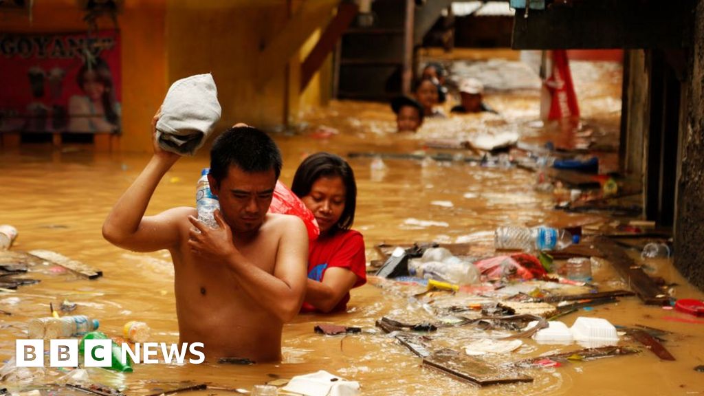
Indonesia has similar issues Jakarta is sinking much faster than the sea is rising. In some areas it has sunken by more than 5 metres (from 1977 levels). 60mm of water rise in 100 years probably doesn't panic most people, but 5m of sinkage in 50 probably does.

Climate change is a real threat, an almost unstoppable one. But it is slow. In trying to study the effects of climate change, we have discovered other more pressing issues that will compound climate change.
 

kiwi in exile

Active Member
@kiwi in exile

Was this an inadvertent post noting it is all presented as a quote? If so I will delete it. If not please Can you please separate the quote from your comment in order to understand your point. Alternatively I can delete it and you can repost.

alexsa
Late night editing of post slip up sorry. Happy for mods to delete prev version of this post.
Intended message:

Tamaki Makaurau MP Peeni Henare has already indicated to Szabó he isn’t very keen to fight through another campaign and would prefer to go list-only.
Big decisions loom on Labour MPs' futures

Has our current def min 'had enough'. If he doesn't have the stomach for a political campaign, I doubt he could handle a military campaign. It's possible he could retain the portfolio if he gets in on the Labour list. Can anyone think of any other contenders in Labours ranks?
Nightmare scenario is Golriz getting the portfolio as part of labor-greens coalition next election.
 

ngatimozart

Super Moderator
Staff member
Verified Defense Pro
Very first glance says it looks like most of it is a significant refinement of estimates of isostatic rebound (land going up/down dependent on changes to ice or lake coverage) rather than big changes to sea level rise projections. Also, wondering which future climate model (or average across multiple CMIP6 series models) they're using... Not clear from the website. Could be the NZ Earth System Model (15-20km resolution round NZ) but that's got some issues with a fresh water imbalance driving long-term model drift in SSH (I'm using NZESM as lateral boundary forcing on some future climate downscaling stuff I'm doing at the moment... Was bloody annoying to blunder across it, but adequately resolved now).
Isostatic rebound has nothing to do with it all. The measures are based on mm quality high resolution GPS data taken over the last 30 years and we know exactly how much annual deformation, movement, and tilt is occurring due to the subduction of the Pacific tectonic plate underneath the the Australian tectonic plate. Before that it was survey data and that was very accurate as well to sub cm resolution. You will find that the projection used is the NZGD2000 NZ Deformation Model. If you use a good GIS you will find that projection in it.

I am sure that if contact them they will provide you with the climate details. WRT the ground deformation data, GNS will have all the info you require. They may even tell you where all the measuring sites are.
 

ngatimozart

Super Moderator
Staff member
Verified Defense Pro
OFF TOPIC
Really! I always check records obtained by measured data, not some climate catastophists assumptions
From the link, which shows recorded mean sea level events, it appears that not much has changed over the last century.
Yes, there is a very small increasing trend but nothing to cause the bs panic in your post.
.
Ah @ASSAIL how far did you go back? 100 years? 200 years?
Being that I did climatology as part of my post grad I can read some of the big words which are two syllables long as well as the pictures.

What a lot of people appear not to understand is that the current climate change is part of a natural cycle that has been occurring over the fast few million years. At the beginning of the 18th century we were on the upwards curve of the cycle maybe 1,000+ years from the tipping point that triggers an ice age. However with the advent of the industrial age we began pumping huge amounts of greenhouse gases into the atmosphere and the addition of these extra gases has accelerated the final part of the cycle of1,000+ years on 1700CE to 500 - 600 years from 1700CE, which is from 2200 - 2300CE.

How de we know this? We measure the mean annual air temperatures and the mean annual sea level from when they were first recorded and plot the trends. The plotted trends show a curve of increasing values, similar to an exponential curve. These values are for a period of about 200 years. However that is only a really short period, so we use other methods to find temperatures and sea levels. Ice cores are good examples because air bubbles within the ice contain significant amounts of information and the ice can be dated to a particular year. Paleogeology is another where sediments can tell us where shorelines were in the past and what the climate was like by the type of fossils found, same onshore.

We know enough about how the climate works that we can model it now and that's how our weather forecasts are generated. The whole planet's climate is modelled on three separate computers in three different countries and then the WMO issues detailed planetary, regional, and national forecasts based on those three models. From models such as those we are able to model future changes to the climate and analyse the impacts. We know that as the atmosphere heats up the oceans will heat up and as they do the water will expand because of the added heat. This has to do with the higher energy state of the electrons within the water molecules forcing them to wider orbits increasing the space between individual atoms within the molecule. So whilst the mass of water maybe the same its volume increases and it has to go somewhere. Add to that the water from the melting ice on both poles, more water is added to the oceans. again it has to go some where and because that water is also warming it's volume per tonne of mass is increasing as well.

The extra heat in the ocean means extra energy for the atmosphere so it's uplifted to the atmosphere (a low pressure system) and the greater the heat transfer the more violent the storm. So storms become more common and more violent, but because of the warmer atmosphere the land becomes drier. In NZ's case most of our water storage is the three glaciers in the North Island and the 3000+ glaciers in the South Island (2010). Since then we have lost a number of glaciers and the rest are significantly retreating. All of the main storage lakes and the big rivers in the South Island are glacial fed.

The science is out there and there are plenty of links available. It's not catastrophism is you put it, but plain simple fact.
 

ngatimozart

Super Moderator
Staff member
Verified Defense Pro
Late night editing of post slip up sorry. Happy for mods to delete prev version of this post.
Intended message:


Big decisions loom on Labour MPs' futures

Has our current def min 'had enough'. If he doesn't have the stomach for a political campaign, I doubt he could handle a military campaign. It's possible he could retain the portfolio if he gets in on the Labour list. Can anyone think of any other contenders in Labours ranks?
I really don't think that we need to go there at all. It's not a discussion that is necessary or desirable at the moment because it delves into politics and fantasy discussions.
 

John Newman

The Bunker Group
That's really low, John and untrue. You know we have strong bipartisan support on defence. Playing cheap politics. Very disappointed in you, thought you were better than that. You seem to have forgotten who led Australia through WWII.
Been busy, and ill, for a few days and just logged in and saw your comment to my post.

If you want to make a personal comment/attack regarding myself, send me a PM, ok?

Doing it in a public forum is the act of a coward.
 

ASSAIL

The Bunker Group
Verified Defense Pro
The sea level in an enclosed harbor is not indicative as to what is happening around Australia in general as the level is controlled by what can flow in and out at any one time. the sea level around Australia has been rising at around 2.1mm per year for the last 50 years.
https://coastadapt.com.au/climate-change-and-sea-level-rise-australian-region#:~:text=Sea levels are rising g
One cannot make the conclusion that Darwin harbour is enclosed, it’s anything but with a huge tidal exchange.
The tides there have been observed from the same gauge in the same position since 1911 and the two highest tides were observed in 1912 and 2017
There has been an mean increase of 65mm over that period some of which can be explained by the gravitational effect when the orbits of the planets align. Interestingly enough that phenomenon is occurring right now so it wouldn’t surprise me if the current king tides are near records.
No sane individual disputes that there is a very gradual rise in sea levels but this has to be tempered by empirical data and further modified by rises and falls in geologically unstable landmasses and the natural growth and sinking of coral atolls.
My interest in Darwin tides had subsided since I have stopped operating dinner cruises on Darwin Harbour and have moved to the Adelaide Hills.
 

ASSAIL

The Bunker Group
Verified Defense Pro
OFF TOPIC

Ah @ASSAIL how far did you go back? 100 years? 200 years?
Being that I did climatology as part of my post grad I can read some of the big words which are two syllables long as well as the pictures.

What a lot of people appear not to understand is that the current climate change is part of a natural cycle that has been occurring over the fast few million years. At the beginning of the 18th century we were on the upwards curve of the cycle maybe 1,000+ years from the tipping point that triggers an ice age. However with the advent of the industrial age we began pumping huge amounts of greenhouse gases into the atmosphere and the addition of these extra gases has accelerated the final part of the cycle of1,000+ years on 1700CE to 500 - 600 years from 1700CE, which is from 2200 - 2300CE.

How de we know this? We measure the mean annual air temperatures and the mean annual sea level from when they were first recorded and plot the trends. The plotted trends show a curve of increasing values, similar to an exponential curve. These values are for a period of about 200 years. However that is only a really short period, so we use other methods to find temperatures and sea levels. Ice cores are good examples because air bubbles within the ice contain significant amounts of information and the ice can be dated to a particular year. Paleogeology is another where sediments can tell us where shorelines were in the past and what the climate was like by the type of fossils found, same onshore.

We know enough about how the climate works that we can model it now and that's how our weather forecasts are generated. The whole planet's climate is modelled on three separate computers in three different countries and then the WMO issues detailed planetary, regional, and national forecasts based on those three models. From models such as those we are able to model future changes to the climate and analyse the impacts. We know that as the atmosphere heats up the oceans will heat up and as they do the water will expand because of the added heat. This has to do with the higher energy state of the electrons within the water molecules forcing them to wider orbits increasing the space between individual atoms within the molecule. So whilst the mass of water maybe the same its volume increases and it has to go somewhere. Add to that the water from the melting ice on both poles, more water is added to the oceans. again it has to go some where and because that water is also warming it's volume per tonne of mass is increasing as well.

The extra heat in the ocean means extra energy for the atmosphere so it's uplifted to the atmosphere (a low pressure system) and the greater the heat transfer the more violent the storm. So storms become more common and more violent, but because of the warmer atmosphere the land becomes drier. In NZ's case most of our water storage is the three glaciers in the North Island and the 3000+ glaciers in the South Island (2010). Since then we have lost a number of glaciers and the rest are significantly retreating. All of the main storage lakes and the big rivers in the South Island are glacial fed.

The science is out there and there are plenty of links available. It's not catastrophism is you put it, but plain simple fact.
I simply observe the tidal gauge which has been on Fort Denison since 1911 (a good year for tidal gauges). It’s the gauge used for the main Port Jackson tidal data, no models, no interpretation, simple data and I reiterate my previous posts, there are very slight rises in sea level in this part of the Pacific.
 

Rob c

The Bunker Group
Verified Defense Pro
I simply observe the tidal gauge which has been on Fort Denison since 1911 (a good year for tidal gauges). It’s the gauge used for the main Port Jackson tidal data, no models, no interpretation, simple data and I reiterate my previous posts, there are very slight rises in sea level in this part of the Pacific.
The rises are a little more than local, try world wide. and I think that the term very slight is a little of an understatement. when you consider the volume of water required to lift the sea level by even 50mm, it is huge.
 

alexsa

Super Moderator
Staff member
Verified Defense Pro
Ok Folks …. This climate issue is way off topic and I suggest this be moved to a thread of its own if you wish to discuss it. If you do … please play nice.

Back to the NZDF discussion please.
 
Last edited:

TScott

Member
Back to the NZDF discussion please.
The NZDF discussion or the NZ Politics thread?

I note there's been 58 posts referencing the NZ Labor Party since the start of March alone.... is there any other thread with a longer rope on this discussion forum?
 

alexsa

Super Moderator
Staff member
Verified Defense Pro
The NZDF discussion or the NZ Politics thread?

I note there's been 58 posts referencing the NZ Labor Party since the start of March alone.... is there any other thread with a longer rope on this discussion forum?
My comment related to the climate issue which beyond the scope of the NZ Defence force.
 

spoz

The Bunker Group
Verified Defense Pro
There is a difference between talking about the policies (and failing) of the government of the day as the government, and the policies (and failings) of the political parties which happen to make up that governmen for the time being. The first falls under the heading of comment on public policy, strategic considerations and defence force development and employment all of which are entirely within the remit of this forum and thread, at least where they have an effect on NZ Defence. The second is politics and is not permitted.

Most of what I count on this Board is criticism of the government of the day as the government - although I would agree some does sail close to the line. One or two of the posts certainly do cross that line, at least in my view, but not egregiously.

You will see similar criticism of the government of the day in threads on Australian Defence, and (especially) both Canadian and UK Defence. That's pretty natural in a forum who subject is defence in all its ramifications and where those government seems to forum members to be behaving either foolishly or incompetently. I'm sure if you were to search out a forum whose focus was on, say, tree hugging the view of each of the governments concerned would be different to those expressed here; and that would be equally valid in their context.
 
Last edited:

recce.k1

Well-Known Member
So talking about defence related issues (or potential for), our Finance Minister a day or two ago talked about setting a new debt ceiling, which will be 30 per cent of GDP, and to quote him, "This will also give time to ensure that in future Budgets we are making investments in the most effective and efficient way possible, in line with the Infrastructure Strategy".

I am wondering whether Defence is (or could be, if they lobby) to have defence infrastructure such as existing bases and future base planning included in with this government "Infrastructure Strategy" planning?

Asking as I would like to see provision for (as in land set aside for) eg additional airbases in case required in the future, or another major Army base say in the upper North Island if expansion at Papakura is constrained by urban development eg Waikato or south or north of Auckland like potentially near Whangarei (as central North Island at Waiouru and Linton is covered, ditto Burnham in Christchurch and the Tekapo exercise area is covered), or Naval forward operating bases and potentially land around Whangarei if the drydock is built there etc.

Back around or prior to WW2 the then government had the foresight to build the two main air bases at Ohakea and Whenuapai which at the time were away from main population centres (and nowadays Whenuapai is severley constrained by rapidly encroaching urban development). We then recently saw with the Singapore F-15 basing proposal that the existing bases are too constrained for various reasons and thought was given to building an air base at Waiouru, which I think was simply a compromise (and possibly a very poor one too). We've also lost the "third" major (training) airbase, at Wigram due to govt policy in the 1990's and encroaching urban development. So there is a need, especially if the world geo-political situation continues to become more threatening. (Another option is to make provision to upgrade existing civil airports at strategic locations to make provision for increased military operations as per WW2 experiences eg space to extend runways and build hard standing areas etc).

Also if new bases could be built (if required in the future) away from urban areas then there could be provision to better protect them against sabotage or terrorism attacks (drones, mortar fire etc) or missile strikes with counter-attack systems (which wouldn't 'wipe out' or greatly impact the nearest town)?

So if defence could be included in Govt "Infrastructure Strategy" planning, at least land could be investigated and earmarked for potential development if future events require it (and perhaps in some cases deemed high priority perhaps vital horizontal infrastructure could be installed eg underground power cables run to the nearest power sub stations etc.

I have no idea if any of this is feasible (except to day it should be imperative for Defence and Govt to be forward-planning, not tackling issues ad-hoc as the need arises), so simply posing the question for discussion and learning from more informed responses etc.

The other thing our Finance Minister said a couple of weeks ago is that with inflation rising putting more money into the local economy would (or could) make things worse .... so could Defence lobby to have potential additional expenditure spent overseas as in major capital purchases (as wouldn't that not negatively impact the NZ domestic economy in a major way)? :)
 
Last edited:

RubiconNZ

The Wanderer
So talking about defence related issues (or potential for), our Finance Minister a day or two ago talked about setting a new debt ceiling, which will be 30 per cent of GDP, and to quote him, "This will also give time to ensure that in future Budgets we are making investments in the most effective and efficient way possible, in line with the Infrastructure Strategy".

I am wondering whether Defence is (or could be, if they lobby) to have defence infrastructure such as existing bases and future base planning included in with this government "Infrastructure Strategy" planning?

Asking as I would like to see provision for (as in land set aside for) eg additional airbases in case required in the future, or another major Army base say in the upper North Island if expansion at Papakura is constrained by urban development eg Waikato or south or north of Auckland like potentially near Whangarei (as central North Island at Waiouru and Linton is covered, ditto Burnham in Christchurch and the Tekapo exercise area is covered), or Naval forward operating bases and potentially land around Whangarei if the drydock is built there etc.

Back around or prior to WW2 the then government had the foresight to build the two main air bases at Ohakea and Whenuapai which at the time were away from main population centres (and nowadays Whenuapai is severley constrained by rapidly encroaching urban development). We then recently saw with the Singapore F-15 basing proposal that the existing bases are too constrained for various reasons and thought was given to building an air base at Waiouru, which I think was simply a compromise (and possibly a very poor one too). We've also lost the "third" major (training) airbase, at Wigram due to govt policy in the 1990's and encroaching urban development. So there is a need, especially if the world geo-political situation continues to become more threatening. (Another option is to make provision to upgrade existing civil airports at strategic locations to make provision for increased military operations as per WW2 experiences eg space to extend runways and build hard standing areas etc).

Also if new bases could be built (if required in the future) away from urban areas then there could be provision to better protect them against sabotage or terrorism attacks (drones, mortar fire etc) or missile strikes with counter-attack systems (which wouldn't 'wipe out' or greatly impact the nearest town)?

So if defence could be included in Govt "Infrastructure Strategy" planning, at least land could be investigated and earmarked for potential development if future events require it (and perhaps in some cases deemed high priority perhaps vital horizontal infrastructure could be installed eg underground power cables run to the nearest power sub stations etc.

I have no idea if any of this is feasible (except to day it should be imperative for Defence and Govt to be forward-planning, not tackling issues ad-hoc as the need arises), so simply posing the question for discussion and learning from more informed responses etc.

The other thing our Finance Minister said a couple of weeks ago is that with inflation rising putting more money into the local economy would (or could) make things worse .... so could Defence lobby to have potential additional expenditure spent overseas as in major capital purchases (as wouldn't that not negatively impact the NZ domestic economy in a major way)? :)
I think we would need to see a seismic shift in political think in NZ before we start seeing that kind of strategic land banking. NZ also has a lot larger difficulty with securing rural land of that size thanks to Treaty/Settlement complexities. Should Devonport ever be moved I think that would be the final blow to Whenuapai, which will be facing additional pressures once No.5 Squadron moves. (starting around now I believe) It’s probably an important time to secure a Air Movements terminal at Auckland Airport even again if it was secured and commercially leased in the medium term.

I believe the decision not to the station RSAF here was a bipartisan lack of will and desire in investing the kind of infrastructure and expenditure required to operate it. From the NZ Ministry Cabinet document release: (Which I’m sure you read, but for others :) .)
However, it was clear that locating Singaporean F-15s at Ohakea on a long term basis was not feasible without significant investment to alleviate the strain operations would place on the capacity of the airfield and the airspace above it.
To sum up it all comes down to the political will to spend the dollar, and that is the only factor I ascribe to preventing the RSAF from coming to NZ.

Interestingly I believe the strategic assessment would read quite different if conducted now.
3.1. The strategic assessment was marginally in favour of the proposal but strongly in favour on foreign policy grounds, based on our shared strategic interests in the region and the bilateral relationship benefits of agreeing to this proposal.
Until reading these documents today I was unaware of the lengths of consideration given to the proposal. Now would be the time to consider increasing the size of Ohakea. Naval Air Stations in the US seem to manage combined aircraft type operations, however, a transfer of fixed wing training to Woodburn maybe the way forward for this even for RNZAF only consideration (If possible). Furthermore there would opportunities for an airfield in Northland should the Navy relocate in that direction the navy rotary wings and a runaway capable of of heavy aircraft operations.
 
Last edited:

ngatimozart

Super Moderator
Staff member
Verified Defense Pro
I don't believe that we require another army base. There are currently four in the North Island:
  • Linton Military Camp.
  • Papakura Military Camp.
  • Waiouru Military Camp and Training Area.
  • Trentham Military Camp.
And two in the South Island:
  • Burnham Military Camp.
  • Tekapo Training Area.
They are more than adequate, because Linton, Waiouru, and Burnham can be expanded.

Devonport Naval Base will eventually be forced out of Auckland and at the moment the most logical relocation would adjacent to Marsden Point in Whangarei Harbour. It could go their along with the new large drydock and associated shipyards. Another naval base will have to be built in the South island somewhere and either Timaru or Dunedin would be the most likely locations.

Whenuapai's days are numbered and it has to move. There's no reason why it couldn't be co-located with the new naval base at Whangarei. Move both 6 Sqn and 40 Sqn up there. A new airbase will have to be built in the South Island and Timaru would be a good spot. It's 160km / 2 hour dive below Christchurch, has a port, not far from the army's Tekapo Training Area, and a 1 hour 30 minute drive from Burnham. It has a pre-existing airport and little commercial air traffic.

Ohakea is getting crowded, so maybe the abinito flight training could be moved to Woodbourne.

WRT to land acquisition and Treaty settlements. Land can be compulsorily acquired under the Public Works Act (1922) and it's only when government land is disposed of later, when it is of no further use to the Government, that the Waitangi Treaty Settlement legislation comes into play.
 

ngatimozart

Super Moderator
Staff member
Verified Defense Pro
The NZ Govt Budget for FY 2022/23 is Thursday 19/5/2022. As usual the Budget reading starts at 2pm and details will be released on the Treasury website. I do not expect much out of it for Defence. WRT to last years budget given the rhetoric over the last 12 months from the Finance Minister I would expect Defence to take a hit. However, the Russo-Ukrainian war has changed things and the Finance Minister to may not get his way WRT Defence funding.

On another note, it appears that the PM is slowly moving NZ's foreign policy closer to the west and US than that previously held for the last 20 years. Apparently this is causing some angst amongst NZ foreign policy wonks, especially those in MFAT, who will now have to do some work and start thinking. If this is indeed the case then it is a good move and about time.

Ardern continues to forge a more US-friendly foreign policy | Stuff.co.nz
 
Top