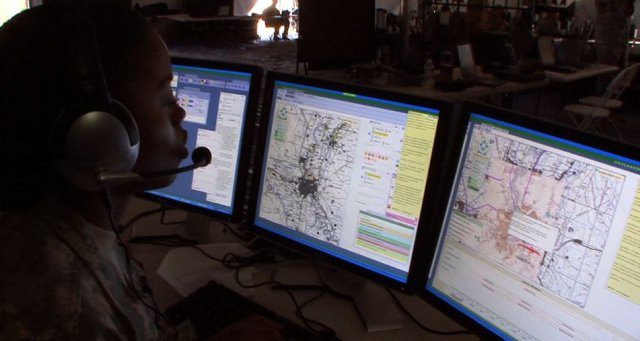
The United States Department of Defense (DoD) is strategically leveraging innovations in geospatial technologies to ensure commanders at every level have a deeper understanding of evolving operational environments.
Multi-fused geospatial products that could serve as a foundation for many modeling and simulation training programs and enhance the ability of military commanders and civilian emergency responders to view target areas from the same aspect, at the same time are becoming popular.
Frost & Sullivan’s US Defense Geospatial Market analysis predicts these trends to boost the U.S. DoD’s spending on geospatial products, services and research, estimating it to reach $2.43 billion in 2018. The largest portion of spending – $900.1 million – will be allotted to engineering and integration initiatives.
The U.S. DoD will look primarily to expand capabilities for collection, processing and creation of data depicting the physical and human terrain. It will also use its funds to strengthen relationships in time and space as well as develop network-centric mission applications that integrate information arising from sensors, signal/image processors, and other sources.
“After engineering and integration, improvements in dissemination and targeting will command the most attention, with spending in 2018 likely to stand at $712.6 million and $579.4 million respectively,” said Frost & Sullivan Senior Industry Analyst John Hernandez. “For targeting, $200 million will be invested to procure a base operations geospatial library that will upgrade a worldwide digital repository of geospatial intelligence products obtained from various data sources at agency and service levels.”
The U.S. air force is the dominant end-user segment, awarding 46.6 percent of total government contracts. The army and joint service organizations are also important end-user groups as the former is very receptive to emerging technologies and the latter has a high latitude for investment since all military departments reap the benefits of its research and development efforts.
The strong demand for 3-D geospatial products is encouraging the development of new light detection and ranging (LIDAR) technologies for defense and commercial use. The U.S. air force is developing a cutting-edge LIDAR technology that expands mapping coverage in less time than current systems. Advances in LIDAR technology to automate the identification of natural and man-made terrain data are also under way.
“With such extensive efforts being made to introduce new technologies, it will not be long before geospatial tools become interactive to the point where they will not only offer a battlefield commander situational awareness, but also suggest possible/logical plans of action,” concluded Hernandez.
Frost & Sullivan works in collaboration with clients to leverage visionary innovation that addresses the global challenges and related growth opportunities that will make or break today’s market participants.


